Aguas Calientes – The Way to Machu Picchu, Peru
TRIP INFO BOX |
|
| Location | Santa Teresa to Aguas Calientes |
| Ticket Price | n/a |
| Return Trekking Time | 4 hours, (+30 min by taxi) |
| Retun Distance | 20Km walking, 16Km by taxi |
| Terrain | Easy, level trek in lush river gorge |
| Flora | Lush jungle/forest |
| Fauna | Various, butterflies |
| Tips | Get fruit from sellers on the way |
(We have discussed the technicalities about planning the Machu Picchu visit in detail in our article “INFO: Machu Picchu Glossary and Planning Guide” so if you’re confused and trying to arrange your visit, click here.)

From Santa Teresa we take a taxi to Hidroelectrica. First we end up waiting for a minibus to fill up at the mercado, but this wait seems it will go on indefinitely so after a half hour, we, a local woman and an American chap named Cooper, all of whom were waiting in the minibus, share a small taxi together.
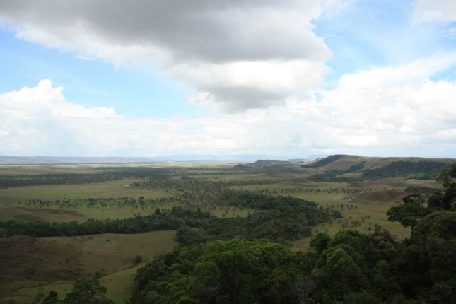
The route is a rough dirt track following the river and there are some excellent views of the tunnels they have constructed into the mountains for their hydroelectric projects, some of them spewing out masses of water from high up.

At Hidroelectrica there’s a few buildings, one of them a hostel/restaurant, one of them possibly an alojamento, but the rest seems to be there to service the railway system and the Hidroelectrica We have to walk uphill, crossing the railway switch-backs and then follow the tracks along the river to Aguas Calientes.
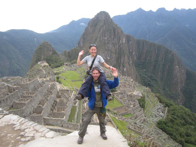
Walking this route is absolutely worth the effort! Over the 10Km it presents us with splendid bottom-up views of the Machu Picchu complex (barely identifiable) and its mountains and thereby adds to the awe of the achievement.


For about about two hours we follow the tracks as the rocks in the river become massive boulders the size of small houses. Cooper walks with us and proves to be pleasant company. Where the river widens and flattens out there is a beautiful old iron railway bridge across it, perfect for some good photographs. The track then takes you past the Puente Ruinas “railway station”, the camp ground and about 1.5Km further it terminates at Aguas Calientes.


The camp site at Puente Ruinas is basic and cheap (15PEN/tent) but it’s a nice lawn next to the river and it has basic shower & toilet facilities. We say farewell to Coop, pitch our tent and then walk the half hour or so to Aguas Calientes to find dinner.


Aguas Calientes looks a bit like a Swiss mountain village. Quite a few classy-looking hotels and restaurants and bars. Of course the slick looking joints will delve into your pocket but budget restaurants can be found, just not as budget as elsewhere.


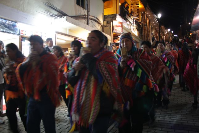
At the time we’re in Aguas Calientes there is some event going on, I don’t really know what it’s about, and there are plenty of local people out on the streets, dressed in traditional rag and marching to band music. I think we’re lucky we’ve come at this time.
2 Comments
Pingback:
Pingback: